Click Here to Return To Milestones Vol 7 No 3
Prior to the erection of Beaver County in 1800, a large portion of Western Pennsylvania was Westmoreland County. In 1787, Isaac Melcher received depreciation plots 15,16,17,18, and 19 on the north side of the Ohio River, now Beaver County, as compensation for his service as a Colonel in the Revoluntionary War. These plots extended from Eighth Street in Ambridge, Pennsylvania, to the South bank of Logstown Run (Legionville Hollow).
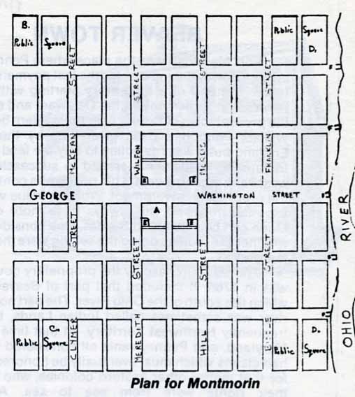
Melcher's plan and the town layout maps were to build a town on these plots - to be called Montmorin and prospects for the Westmoreland County Government seat. 1788 maps exist, showing a complete town layout, with all streets named. Provisions were made for public parks, schools, churches government buildings, poor house and wharfs on the river for each principal street.
A complete description of Montmorin was advertised in the Pennsylvania Gazette of Philadelphia. For each sale of ten lots the buyer would be entitled to a shore outlet. Money was extremely scarce after the Revolutionary War, and the plans for the town were never carried out. However, the Harmony Society in 1824 bought up all of these parcels of land and much more from eight or nine subsequent owners. They partially carried out the Montmorin plans in their town.
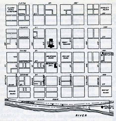
Examine the layout for Montmorin and for the town of Beaver. They are very similar.