Click Here to Return to Milestones
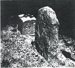
Research into how and why this stone is here revealed the following intriguing information. This Pennsylvania - Virginia boundary stone was the last and northernmost marker put in place by surveyors authorized jointly by commissions of these two States. It was the final delimitation of the thin strip of Virginia's land that lies between the State of Pennsylvania and the Ohio River. (This section is now referred to as the western West Virginia panhandle.) And it finally settled boundary confusion that had persisted in the eastern part of the country for over 175 years.
It all began with the vagueness of the original land grant charters dispensed by the English kings to William Penn, Lord Calvert and the Virginia Land Co.
Through the years they kept appealing to the mother country for help to solve the boundary inconsistencies with no avail. Apparently they had no reliable solution.
Finally, by 1763 the scientific field had advanced to the place where extremely accurate measurements could be made by using an instrument that utilized the stars. Two young men, Charles Mason and Jeremiah Dixon were dispatched to the colonies from England. With their no nonsense approach and the newly invented Sector they established the Pennsylvania - Maryland boundary (The Mason-Dixon Line) and also ran the Pennsylvania - Virginia (now West Virginia) line beyond Dunkard's Creek. Here friendly Indians suggested, convincingly, that they stop surveying. They concurred, returned to Philadelphia and then back to England in 1767.
With the revolution fomenting on the horizon, most serious surveying activities stopped.
At the conclusion of the war, with the Americans being victorious, they were now responsible for the solving of their own boundary problems. Commissioners appointed from the two States hired the most capable people available to finish the task. In 1784 they began where Mason and Dixon had stopped. They extended the line the final 38 miles to the comer of Pennsylvania, 5 degrees west of the Delaware River as prescribed in William Penn's charter.
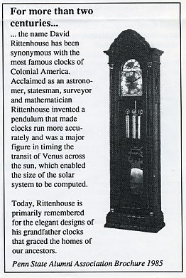
This survey began in July of 1784 and was finished on November 16, 1784. The surveyors for Pennsylvania were Dr. John Ewing, Dr. David Rittenhouse, John Lukens and Captain Thomas Hutchins. For Virginia they were Andrew Ellicott, Bishop James Madison, Rev. Robert Andrews and John Page. Rittenhouse, a clockmaker from Philadelphia made a copy of the English Sector and it worked with great precision.
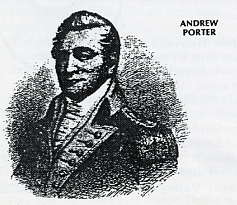
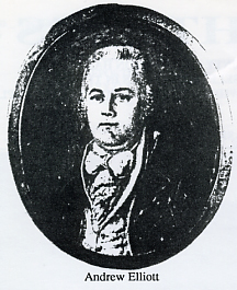
On June 6th, 1785, some of the same men began the line due north. They finished on August 23, 1785. The men who led this segment were strong personalities of much intelligence and devoted scholars in their field of math, astronomy and practical engineering. Major Andrew Ellicott and Joseph Neville represented Virginia. David Rittenhouse and Col. Andrew Porter represented Pennsylvania. A contingency of support workers was headed up by Joseph Ellicott, Andrew's brother.
A letter written by Andrew Ellicott to his wife, Abigail, dated August 24, 1785, states - "We now lay encamped on the banks of the Ohio and intend crossing it tomorrow... The boundary line between the States of Virginia and Pennsylvania was compleated (sic) on the 23 day of this month."'
The joint Pennsylvania - Virginia Commissioners made known in their report of the same time - "We have carried a Meridian line from the southwest comer of Pennsylvania northward to the River Ohio and marked it by cutting a wide vista over all the principal hills... we have likewise placed stones marked on the east side 'P' and on the west side 'V' on most of the principal hills and where the LINE STRIKES THE OHIO..."
When this line was extended across the river, the point where it touched on the northern bank is where on September 30,1785 Thomas Hutchins, the Geographer of the United States, and his group of Federal surveyors, began surveying the NORTHWEST TERRITORY.
This stone marker, which has been here on
this bank for 200 plus years (it was kidnapped for a while) has
seen much of the best and the worst of our country's expansion.